
(click here for larger picture)
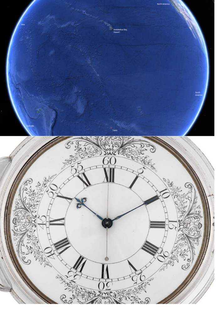
The upper image is of Moana Nui, The Great Ocean, the Pacific Ocean. It’s the largest feature on the face of Earth. Centuries before Captain James Cook met his demise in Kealakekua Bay, Polynesians had been traveling this ocean using star trails and wave patterns. Europeans had developed a gridwork of latitude and longitude for navigation. To establish latitude, an astrolabe would do, and a compass would point the ways to north and south. But longitude was the most difficult problem ever. The maritime empire of Britain established a Board of Longitude in 1714–14 years before James Cook was born–to award a huge prize to anyone who could find a way of establishing longitude accurately.
On Cook’s second and third voyage to the “South Seas,” he had on board Larcum Kendall’s proof replica of John Harrison’s 4th attempt at creating a chronometer that was accurate enough to establish longitude on the high seas. The face of the instrument is shown in the lower image. After Captain Cook died, British ships returned to that little point on the map where he had indicated were the islands of Hawaii. And they did this without the living Captain Cook or his departed spirit to guide them.
John Harrison died a rich man.